Ma Pi Leng Pass Ha Giang: Complete Travel Guide
Ride the most dramatic section of the Ha Giang Loop between Dong Van and Meo Vac, with limestone peaks, deep canyon views and the Nho Que River far below.
Quick answer
Is Ma Pi Leng Pass worth visiting?
Absolutely. Ma Pi Leng is the signature mountain-road experience of the Ha Giang Loop. The pass combines a historic section of the Happiness Road with views across limestone peaks, deep canyons and the winding Nho Que River.
Meo Vac is only about 24 km from Dong Van, but official Vietnam Tourism guidance says the journey can take most of the morning when you stop for panoramic views. That is the right way to plan it: slowly, in daylight and without turning every curve into a rushed photo stop.
Essential facts
Ma Pi Leng Pass at a glance
What to see
The three Ma Pi Leng experiences travelers confuse
Ma Pi Leng is not one single platform. It is a mountain-road area with different viewpoints and side experiences. Knowing the difference makes the day safer and easier to plan.
The best first visit usually combines the main pass, carefully selected Nho Que viewpoints and enough time to appreciate the road’s history. Add the boat trip when your itinerary has the time; add the Sky Path only when conditions and your ability make it sensible.
Current safety update
The Skywalk photo-rock area is temporarily closed
The main QL4C pass remains a different route used by regular local traffic. However, the exposed photo-rock area often called Skywalk Ma Pi Leng or the “death rock” is not the standard main pass road.
Tuyen Quang’s tourism authority states that this photo-rock area has been temporarily closed to visitors from 1 July 2026 until further notice because safety measures were not yet sufficient. Do not enter it unless an official notice confirms that access has reopened.
The White Cliff walking route is also a separate experience. Its access and managed sections should be confirmed locally rather than inferred from an old map pin or social-media video.
- Do not cross closure signs or barriers for a photograph.
- Do not stand at an unmanaged, exposed cliff edge.
- Do not attempt a side trail in heavy rain, strong wind, fog or fading daylight.
- Ask a local guide to confirm whether the White Cliff walking route is currently managed and accessible.
Read the official July 2026 safety notice. Current signs and local authority instructions remain the final authority.
Want the view without managing the mountain road?
Choose an Easy Rider. You can look at the landscape, take photographs and let a local driver handle the curves, traffic and weather changes.
Route planning
Dong Van to Ma Pi Leng and Meo Vac
The classic direction leaves Dong Van after breakfast, follows QL4C toward Ma Pi Leng and descends toward Meo Vac. Ha Giang Vibes also rides the section in reverse on some 4D3N itineraries. Both directions are scenic.
- Leave Dong Van in daylight. Check visibility, rain and warm layers before climbing.
- Use designated stopping areas. Never stop in a blind bend or narrow traffic lane.
- Pause around the main pass. Learn the Happiness Road history and photograph the wider landscape.
- Choose the river plan. View Nho Que from above or allow several extra hours for the boat detour.
- Continue to Meo Vac or Du Gia. Keep enough daylight for the remaining mountain road.
Vietnam Tourism’s four-day route notes that this short distance can take most of a morning because of the panoramic stops.
Road with a story
Why it is called the Happiness Road
Ma Pi Leng is part of the historic Happiness Road connecting Ha Giang City with Quan Ba, Yen Minh, Dong Van and Meo Vac. Official tourism records describe thousands of young volunteers and local workers building the road largely by hand from 1959 to 1965.
The roughly 21 km Dong Van – Meo Vac section was the hardest. Workers broke rock on steep cliffs, and this part alone took nearly two years. The road should be understood as cultural history as well as a scenic motorbike route.
Learn more from the Viet Nam National Authority of Tourism’s account of the Happiness Road.
Geology and landscape
Why Ma Pi Leng looks so dramatic
Ma Pi Leng sits inside the Dong Van Karst Plateau UNESCO Global Geopark. UNESCO describes a landscape dominated by limestone, with geological history extending more than 550 million years.
From the pass, erosion and tectonic processes are visible in the deep canyons, sharp peaks and exposed rock layers. Below, Tu San Canyon reaches about 700-800 metres in depth and the Nho Que River traces the valley floor.
Visibility and seasons
When is the best time for Ma Pi Leng Pass?
There is no month that guarantees clear views. High mountain weather can change quickly, and cloud can hide the river even when Dong Van looks dry.
October and November often attract travelers for cooler weather and buckwheat flowers; spring brings blossoms; summer is greener but wetter. Choose the route for the season, then make the final riding decision from the actual conditions that morning.
Mountain-road safety
Is Ma Pi Leng Pass dangerous?
The main road is used every day, but it demands attention. Tight curves, changing surfaces, buses, local traffic, fog, animals, construction and exposed edges can appear in the same journey.
- Ride only with valid documents and real experience. A rental motorbike does not make a traveler legally or practically ready.
- Stay in your lane and enter bends slowly. Expect an oncoming vehicle even when the road looks quiet.
- Use both brakes progressively. Avoid sudden braking while leaned over on gravel or wet paint.
- Stop only where the bike and group are fully clear of traffic.
- Do not ride after dark. Visibility, animals, unlit vehicles and fatigue increase the risk.
- Follow local weather decisions. Skipping a viewpoint is better than forcing an exposed stop in unsafe conditions.
Vietnam Tourism advises travelers to approach curves cautiously, ride during daylight and use a local driver for these roads when appropriate. Read our Ha Giang Loop safety guide and licence guide.
Pass plus river
Should you add the Nho Que boat trip?
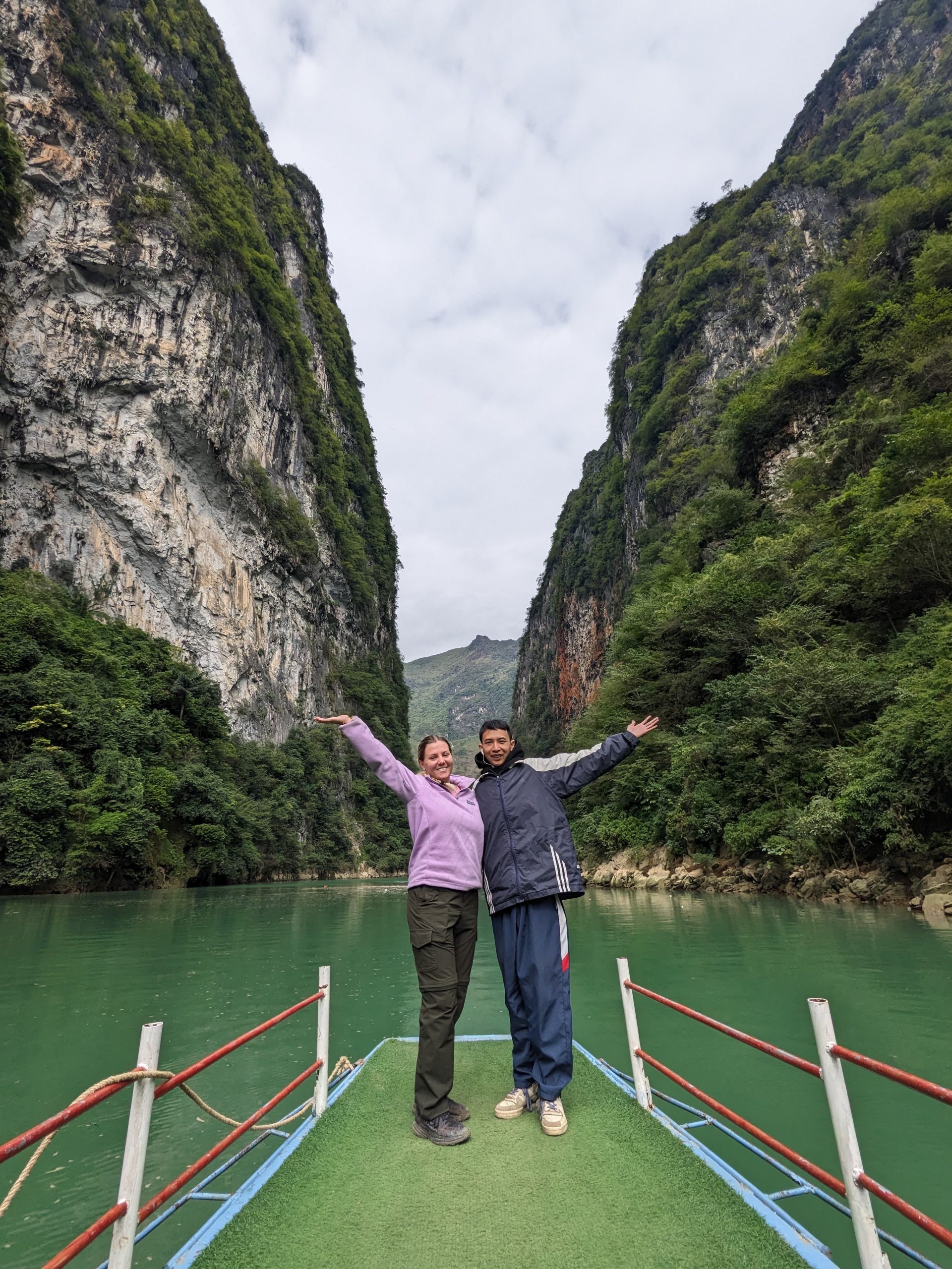
Yes when your itinerary has enough time. The pass gives the full canyon scale from above; the boat puts you between the walls of Tu San Canyon. These are complementary experiences.
- 2D1N: prioritize the main pass and viewpoints; ask whether the boat can fit without rushing.
- 3D2N: our Day 2 route schedules Ma Pi Leng, Nho Que boat trip, Meo Vac and Du Gia.
- 4D3N: our Day 2 route approaches from Meo Vac, includes the boat and continues over Ma Pi Leng to Dong Van.
- Private tour: best for photographers, couples, families or travelers who want more control over stops.
Use our complete Nho Que River boat guide to understand access, timing and safety.
What to bring
Pack for wind, sun and sudden rain
- Certified helmet that fits correctly.
- Windproof rain layer and a warm layer outside hot weather.
- Closed footwear with reliable grip.
- Sun protection, water and a small snack.
- Phone strap or secure camera bag.
- Cash for local services, parking or food.
- Only a small day bag; store large luggage in Ha Giang before departure.
Choose the right Loop
Best Ha Giang tours for Ma Pi Leng Pass
All three main Loop lengths visit Ma Pi Leng, but they offer very different pacing. Choose based on the experience you want, not only the lowest price.
2D1N Short Loop
Best when time is limited. Focuses on Dong Van, Ma Pi Leng and the main Nho Que viewpoints.
Easy Rider: 3,990,000 VND
Self Ride: 2,990,000 VND
3D2N Classic Loop
Best compact first trip with Dong Van, Ma Pi Leng, the boat trip, Meo Vac and Du Gia.
Easy Rider: 4,990,000 VND
Self Ride: 3,490,000 VND

4D3N Relaxed Loop
Best overall pace with quieter roads, Du Gia, the boat trip, Ma Pi Leng, Dong Van and Lung Cu.
Easy Rider: 6,590,000 VND
Self Ride: 4,590,000 VND
Need a private pace?
Private upgrade is +500,000 VND per person. It is useful for couples, families, photographers and travelers who want flexible stops.
Ha Giang Vibes approach
The best viewpoint is one you reach without rushing
Ha Giang Vibes was founded by Hoang Hai Vu, a local driver since 2019. We plan Ma Pi Leng around daylight, current road conditions, safe stopping areas and the comfort of each group.
- Local Easy Riders familiar with the Dong Van – Meo Vac road.
- Small groups and private options with realistic viewpoint time.
- Clear written itinerary and current inclusions before payment.
- One-way VIP cabin bus from Hanoi or Sapa for confirmed bookings.
- Private ensuite pre-tour room at our Ha Giang hotel.
- Private-room upgrade during the Loop: 500,000 VND per room per night, subject to availability.
Guest perspective
Travelers remember the driver as much as the view
Verified planning
Official sources used for this guide
Road conditions and access arrangements can change. We use official references for stable facts and confirm practical details locally before departure.
FAQ
Ma Pi Leng Pass FAQ
Where is Ma Pi Leng Pass?
It lies on QL4C between Dong Van and Meo Vac in the northern Ha Giang travel region, inside the Dong Van Karst Plateau UNESCO Global Geopark.
How long is Ma Pi Leng Pass?
The pass section is commonly described as about 20-21 km. Dong Van and Meo Vac are roughly 24 km apart.
How long does Dong Van to Meo Vac take?
Official Vietnam Tourism guidance says the short distance can take most of a morning with scenic stops. Add much more time for the Nho Que boat trip or Sky Path.
Is Ma Pi Leng Pass dangerous?
The main road is used daily but requires careful mountain riding. Curves, fog, rain, traffic, roadworks and exposed edges mean travelers should ride in daylight or use an Easy Rider.
Do I need a licence to self-ride?
Yes. You need documents valid for the motorcycle category in Vietnam as well as suitable experience. Choose an Easy Rider when your licence or confidence is not sufficient.
Is the Sky Path the same as Ma Pi Leng Pass?
No. The main pass is QL4C. The exposed Skywalk photo-rock area is separate and has been temporarily closed since 1 July 2026 until further notice. White Cliff is another walking route whose current access should be confirmed locally.
Can I see Nho Que River without taking the boat?
Yes. Several viewpoints show the river from high above. The boat trip is a separate experience inside Tu San Canyon.
Is there an entrance fee for Ma Pi Leng Pass?
The main pass is a public road rather than one ticketed attraction. Managed viewpoints, parking, the boat trip and other local services may have current fees.
Which tour is best for Ma Pi Leng?
Choose 2D1N for the shortest route, 3D2N for the best compact first visit with Nho Que and Du Gia, or 4D3N for a more relaxed pace.
Why do some current maps mention Tuyen Quang?
Following Vietnam’s administrative reorganization, some official addresses may use the expanded Tuyen Quang Province. Ha Giang remains the widely used travel-region name and the term most visitors use for the Loop.
Give Ma Pi Leng enough time to become more than a roadside photo
Send your date and travel style. Ha Giang Vibes will help you choose a safe Easy Rider or Self Ride route with the right pace for Dong Van, Ma Pi Leng, Nho Que and Du Gia.